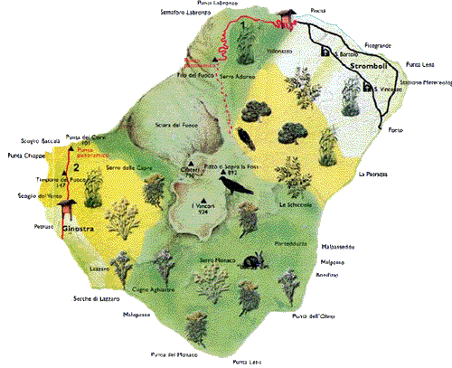
Stromboli – Filo del
fuoco
Distance: Km 4,7
-
Gradient: m 250
-
Time:
2 hours -
Difficulty: easy
Leaving from Chiesa di S.Vincenzo, heading northwards, we cross the
village.
After about m 1,500 we reach Piscità, where the real
path begins. Continue
along
for another m 500 skirting Torrente Vallonazzo where a wooden hut
marks the beginning of the Nature Reserve. We continue upwards on
gently sloping terrain for another 1,200 meters until we come
to the Labronzo weather station (m 115 alt.). There are clear
indications in different languages on how to tackle the climb in the
correct way. From the fork, taking the right, we reach the weather
station: turning left we start along a sign-posted stone paved road
which, after a series of turns, in the midst of a real explosion of
colours, looks onto Filo del Fuoco (m 275), after about m 1,500. Up to
this point the itinerary is relatively easy and well within the skill
of most excursionists. Those who wish, however, to proceed onwards to
the mouth of the volcano should be warned that the pathway is not
good, and often crosses over loose, slippery volcanic sands. For this
reason a qualified guide is highly recommended.

 Itinerary 2
 Itinerary
Stromboli